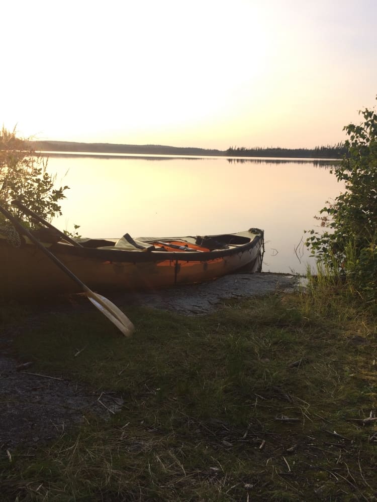
Get Lost, or don’t. A blog about canoe navigation…
On a recent paddling trip down the Paull River this summer our paddling crew came to the realization that today’s maps offer a variety of details, or sometimes a lack of details. This was my 4th canoe trip on the Paull River departing from Paull Lake and I have had 4 additional partial trips on the Paull River from various starting points downriver. I was paddling the trip from memory and leaving the others in the group to work on their navigation skills. In our group of 6 paddlers, we had 3 sets of maps, a Go Trekker Map from 6-7 years ago, a new Go Trekker Map from this year, and a set of Government issued 1:50,000 topo maps from ISC in Regina. I had sandwiched this trip in-between a couple of courses I was teaching in Missinipe, so with being quite busy prior to the trip, along with my familiarity with the river, I was not too concerned about our route.
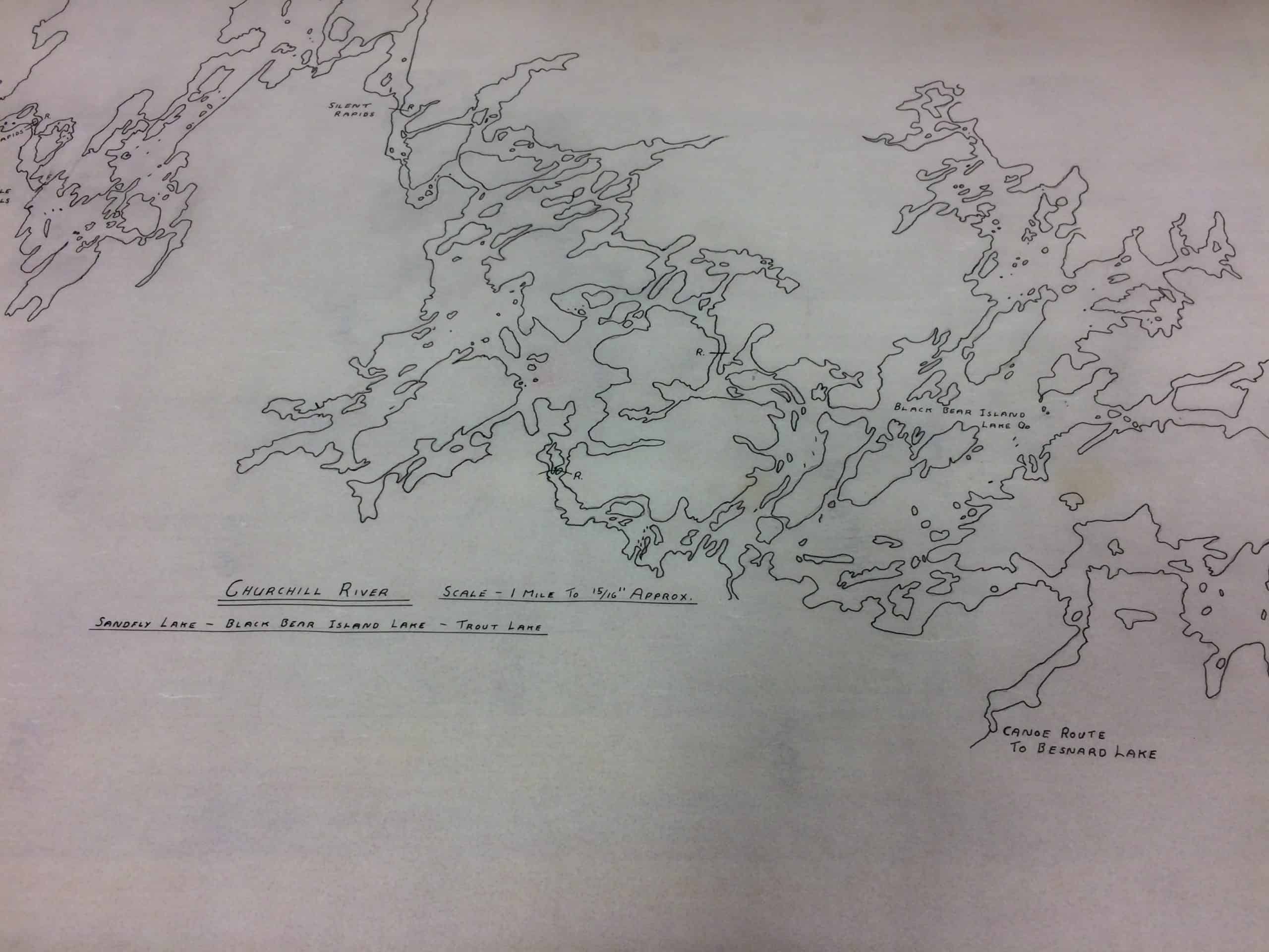
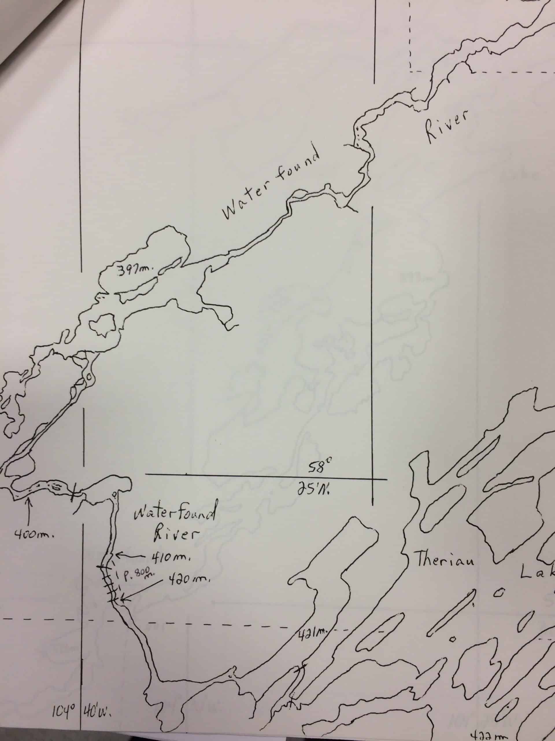
A tradition amongst paddlers is to pine over maps all winter long to create routes to paddle in the summer. Once you have a trip planned, it’s an adventure to research the route and collect notes about rapids, portages, campsites, or to collect historical information. These notes get transcribed to the maps and you print out any other guide notes or information you may need and you ready to head on your way.
I have been paddling in Northern Saskatchewan for just over 20 years now. Far more years than some people, but way fewer years than others. In my early years of canoeing I was very fortunate to have great resources for canoe route notes from the likes of Peter Whitehead and Marcel DeLaforest from the Historic Canoe Trails Club in Regina, and my paddling mentor Kevin Schultz with his many years working for Churchill River Canoe Outfitters.
Marcel had amazing notes which he would dig out once he learned I was planning a certain trip, or he would come by my store after I had returned from a trip to compare notes. Kevin was the most amazing resource as I can only imagine he has logged more miles in the canoe than any other in our province. He impressed me with his knowledge when I was planning my 2ndtrip down the Paull River. I was working off my maps on the kitchen table speaking with Kevin over the phone. Kevin was outlining specific details about shorelines, campsites, rapids with such precision yet he did not have any maps in front of him while relaying these details. The handing-down and sharing of map intelligence is no different than how the maps and routes were created in the first place, information was passed down from paddler to paddler, explorer to explorer, adventurer to adventurer.
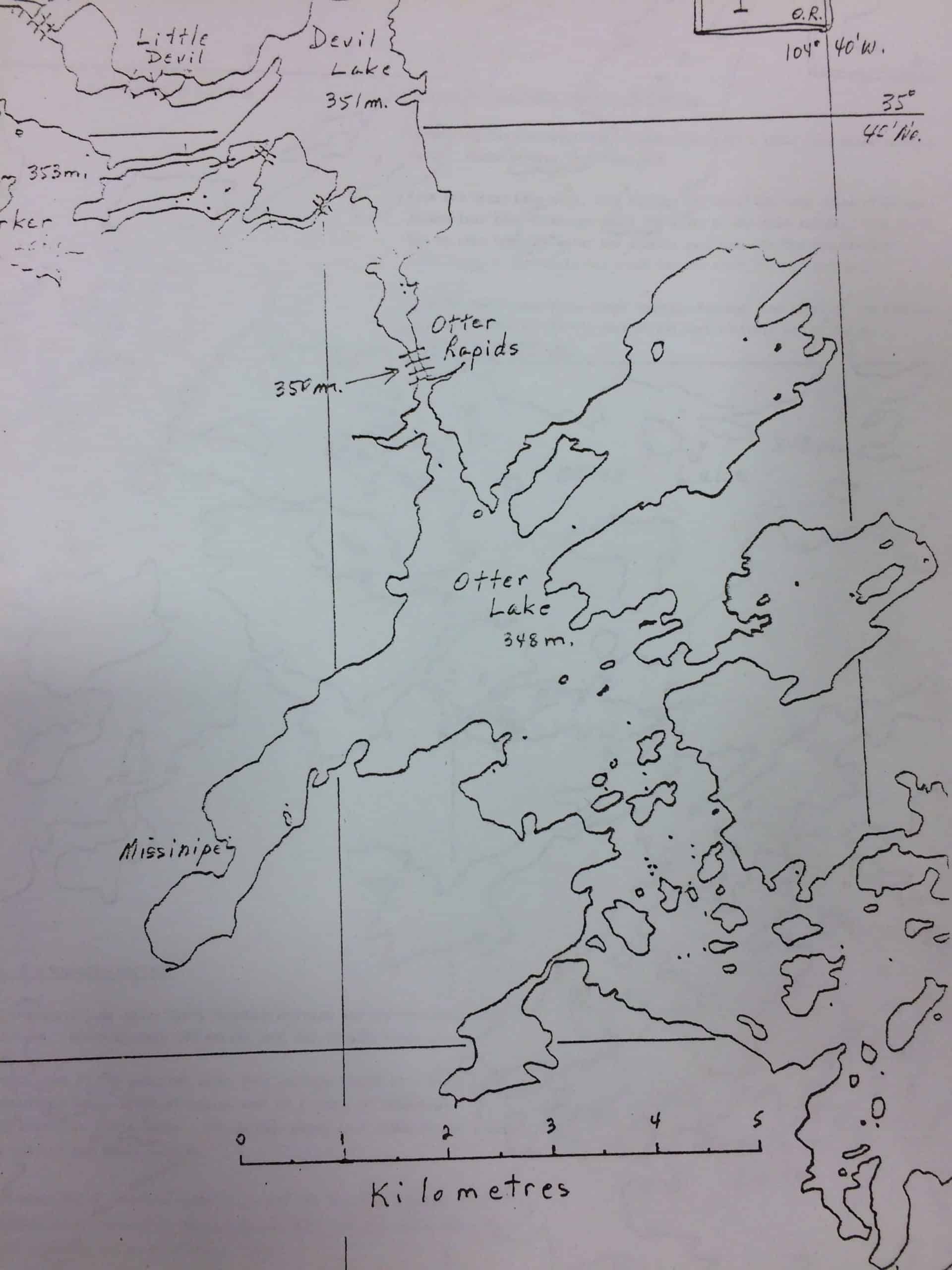
I can remember paddling the Foster River in 2005, in very high-water conditions. A week before we did the trip I was teaching a course to 4 Danish fellows that were also flying off to paddle the Foster. I spent a day with them upstream from Otter Rapids teaching the whitewater skills they would need for the trip. When we flew out to paddle the Foster a week later for our own trip, it was already apparent on day 2 of just how high the water really was. The portage trails were flooded out and we were actually able to float our loaded canoes down the portage trails with only the occasional lift over a fallen log or a large rock. This was absolutely incredible and kind of fun, but a little ominous of what we would encounter later on in the trip. I kept thinking I would run across those 4 Danes and they would be furious at me for not teaching them enough, and not preparing them for such a swollen river where the maps and trip notes don’t line up very well at all with what you are physically experiencing in-person.
Fast forward to Spiral Falls on the Foster River and the absolute lack of any sign of a portage trail. The falls were massive and spilling over on both sides into the bush. The recent burn made bushwakking a horrible option. Our only method of getting through was to cut and create our own portage trail. For 4 hours we cut a path that would get us through. Part of the trail was on the rock next to the falls which was a little precarious because of the high water running over the rocks. Tired and exhausted we made it through and survived the rest of the trip. Upon arrival back in Regina I promptly called Marcel and told him about my trip over the phone. Next thing I knew he was in the store armed with notes, maps, and pictures from Spiral Falls. It turns out the portage trail is directly along the rocky shoreline after all, but with the extremely high-water level, that was not an option for our paddling crew. It was fantastic to see his notes and pictures, and then show him mine. Marcel passed away a few years back and Saskatchewan, and parts of the canoeing world have lost an incredible resource, but luckily many of his notes live on in the SK canoe booklets.
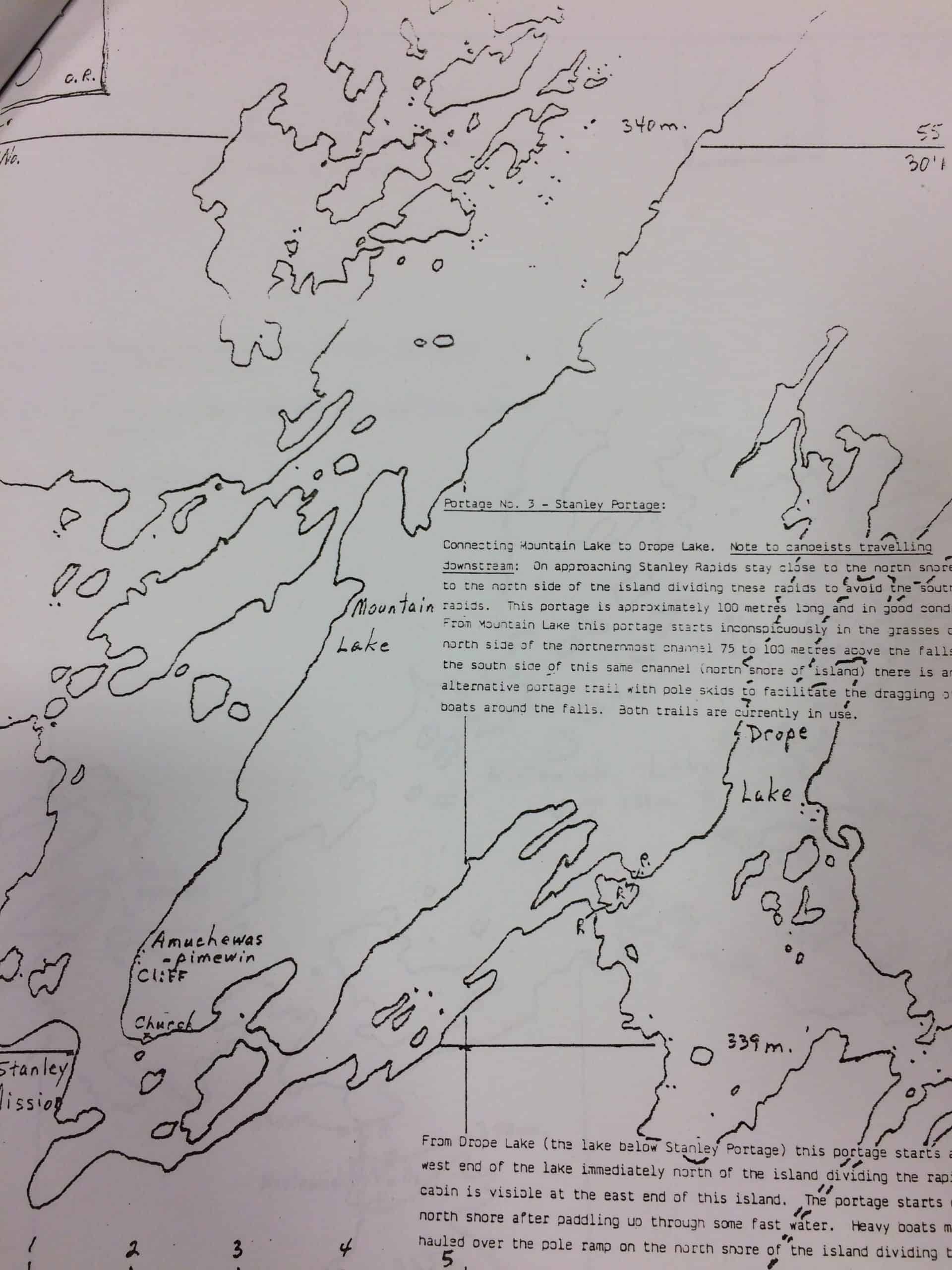
 Last summer I was visiting with another great Saskatchewan Canoe legend, Peter Whitehead. I had learned that Peter was ill and I wanted to visit with him. I was also preparing for my Hawkrock River trip to which Peter was interested in as well, Peter only knowing one other person that had paddled the river many years previous. During my visit with Peter he told me about how many of the maps and notes came to be in SK. Not having the resources of today, Peter and Marcel traced Government Satellite maps using a light box onto trace paper. From the trace paper they then retraced the canoe routes onto legal size paper which would then be more durable for travel. Thinking about all their work to prep for a trip, I started feeling guilty about the maps and information available to me for my upcoming Hawkrock River trip. My solution was to buy the standard 1:50,000 canoe topographic maps from ISC in Regina rather than the Go Trekker Map that was available with notes about camp sites, rapids, and various sites. Having learned from the staff at CRCO that there were no rapids on the river greater than a Class 2, I didn’t need to note any hazards, or portages. The only notes I made on my map before the start of my trip was to mark the put in on Forest Lake, a bridge on the road to Stoney Rapids that we paddled under, and 2 possible take out points, which both happened to be on the Fond Du Lac River (which the Hawkrock drains into). My plan was to record notes every night and mark my maps with information to possibly pass down to future Hawkrock paddlers. My plan went great and I experienced a level of adventure on this trip unlike any previous canoe trip. When I returned to Regina to share my adventure with Peter, I learned he had passed away. Peter had set aside some old traced maps for me including the popular route of Missinipe to Nistowiak. Using a typewriter, Peter had marked notes on the map including information about portages and rapids. I look forward to paddling this route using only Peter’s map and notes and sharing this history of how maps came to be with my family and friends.
 I have never had a full-size topo map let me down on a trip. I realize that I have shelled out more money on paper maps than others who have bought the maps for their computers or GPS. Let me list the issues that fellow paddlers have faced with these various technologies.
My first GPS on a canoe trip was exciting, then extremely disappointing. We were paddling from Sandfly Lake to Missinipe with some friends and they had a GPS that they had just bought. The trouble is the GPS only knows where you are, and what you program into it. The old versions were hard on batteries and I remember that between the GPS, a camera, and my new Steri-pen for water filtration, we had a LOT of weight in spare batteries. The only feature of the GPS I enjoyed was the rate of travel. It was great to discover that paddling into a head wind did not slow us down as much as it feels like, and when you are in current you can clip along pretty good, up to 15km/hr at one point. I have heard other horror stories from fellow paddlers who relied solely on GPS for northern canoe travel. (The size of the screen and the lack of details like reefs, to name a few.) One crew I know of got lost on the Paull River after following their GPS and a bad piece of information in canoe trip notes, something a large topo map certainly could have prevented. I realize with new models you can do more plotting but I also chuckle at the stories when a GPS is telling you that you are off-course because you chose the leeward side of an island instead of your original plotted route.
Owning the maps on your computer and plotting and printing out your route can also seem like a good idea. Right up to the point where you realize that you are missing out on some valuable details to the left and the right that didn’t fit on the paper when you printed. Remember that great navigation skills rely on additional information like heights of land, incoming creeks, etc. Just a few weeks ago I heard yet another story about a trip gone wrong because they tried to use this technology. Their final words to me were “never again, from here on in, only full-size topo maps”.
Coming full circle back to my recent Paull River trip with the multiple maps and the conflicting notes… It was a great adventure in itself to dissect the information and I was very grateful for my previous knowledge of the trip. The first issue happened right off the bat with the most recent printing of the Go Trekker Map referring to Stewart Rapids (which flows out of Paull Lake) a Class 2+. Knowing that this rapid is difficult to see without a lot of bushwakking, the portage trail is quite well worn by the fishing outfitter, and remembering this rapid doesn’t end well, our crew decided to portage. A different canoeing group that started the river a few days before us didn’t fair quite as well. They first portaged their gear and then decided to run the rapid, in which they ended up tipping over in the middle section, but luckily didn’t wrap their canoe, or have bodily injuries, on the last drop into Paull River. Of course, the blame is on them, but the 2+ designation of a solid Class 3 rapid is not helpful at all. In addition, this listing then lead them to portage a few more very runnable rapids further downstream that shared the same 2+ designation.
Something to consider is that pre-plotted points on a map such as portage trails, campsites, forest fire burns, and rapid classification should be open to interpretation, just the same as notes in a guidebook. I mean who plotted those points, have they been there, what is their whitewater classification experience, and what is their accuracy??? To maintain both the present and future of canoe tripping, we need to go back to blank topographic maps, and source our information about river trips in guidebooks, trip notes, and stories from previous travellers. Having made Laurel Archer’s book my unofficial paddling trip bucket list, and from completing the majority of those trips, I feel most comfortable with plotting UTM’s from her notes and referencing her written word to gauge the accuracy of the plotted points. That way I am able to find the beautiful 4 Star Bench camping spot rather than paddle past it because the spot was “misplaced” on the map. Another key point about plotting your own data on a map is that you know that it might not be 100% accurate so you don’t take the notes as literal as if it was already presented to you printed on the map. I have experienced guide books with little mistakes but by plotting them myself ahead of time, I am able to figure some of them out. For example there is a reference to a portage trail in a guide book on the Paull that says the portage for the Gorge is in a bay on RR when its actually on RL. This mistake is easily caught when looking at the topo map and realizing which way the river travels after the portage.
 Before you read into this blog thinking that I am telling you to never buy Go Trekker Maps please understand that it’s actually just the opposite. BUY their maps, but only as an additional resource for your canoe trip, not the sole map of your canoe trip. Don’t replace the beautiful process of canoe trip planning with a single map purchase. What I am really recommending is to take a Canoe Tripping Course from Paddle Canada and learn about map reading skills and compass skills from an expert. Failing that, at least spend the winter pouring over your maps, marking them with all your notes. Join a paddling club, ask for advice and stay away from people that answer how a trip was with the general statement “oh that trip is great” because they have a tendency of lacking the details you may require. Let’s keep the tradition that was started by people like Marcel DeLaforest, Peter Whitehead, and Kevin Schultz, and pass on the valuable details for future generations. Let’s avoid modernization of canoe mapping so it can truly remain a wilderness activity unlike the alpine routes, hiking trails, and climbing routes of today. Above all, let’s put our maps down from time to time as we paddle a lake or river and get lost, only to be found again with our developed map-reading skills a few kilometres downstream.


Comments